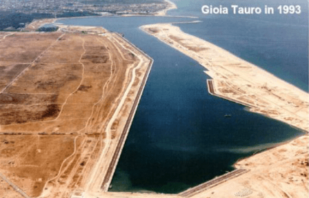
The construction of the port of Gioia Tauro began in the first half of the 70s as part of a special project for the construction of infrastructure on the territory of the province of Reggio Calabria (CIPE 1974). The size and structural characteristics of the work were determined from its original functional purpose in the service of industrial settlements planned by the Government, which provided for the creation of the V center in Calabria Italian iron and steel.
 At the end of the 70s had been delivered the main harbor works (docks, piers, docks).
In the early 80s he stopped the program of work for the known crisis in the steel industry. The airport was then converted to a multipurpose industrial port with the need to restructure the programs of infrastructure, the operational framework and development plans.
The availability of large spaces close to the docks, the amplitude of the berths and the depth of the seabed, referring to the size of the other national ports, have paved the way for the new functional structure of the port.
The prevalence of the type of container traffic that has established itself in the late 80's and the special favor conferred by its geographical position along the median Suez - Gibraltar into the Mediterranean Sea and center of gravity, oriented their future characterization as a port of transshipment of unit cargoes and containers in general.
Operational activities began in 1995 and has grown at a fast pace to have employed at the airport in short the leading role in the field of transhipment which now distinguishes arousing the primary interest of major shipping companies.
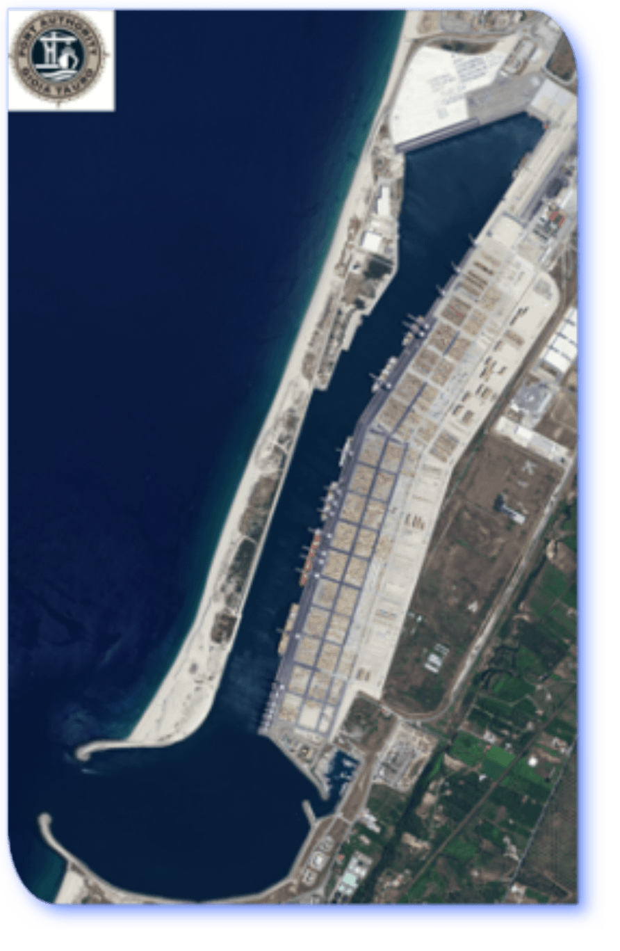
The port area is made up of public seaside areas, from the docks and the water spaces in front of the territorial district to the port authority as identified in the MD August 4, 1998. as well as the areas acquired after delimitation of the maritime domain with the minutes of February 12, 2002.
The port district has a total area of 4,400,000 square meters (440 has), excluding the water spaces and related areas are shown in the cadastre map sheets no. 1-3-7-8-13-19 and 20 of the town of Gioia Tauro (RC) and no. 31 and 32 of the municipality of San Ferdinando (RC).
The port is situated in the middle position along the coast of the gulf to the west of the entrance with exposure identified by the coordinates: lat. 38 ° 26'36'' N and long. 15 ° 53'30'' E.
It has a channel configuration with a mirror surface water inside of 180 acres located parallel to the coast.
The mouthpiece has a width of about 300 m., And is contiguous to it a basin of evolution of the diameter of 750 m. .
In the north it develops the harbor channel length of about 3 km and a minimum width of 200 m, extended to 250 m in the initial section.
At the extreme north of the canal is a further evolution of the basin diameter of 500 m ..
It has 5,125 m. of docks of which m. 3,391 made along the east side, m. 814 along the north side and m.920 along the west side with depths of up to -18 m (corresponding to the deep water quay).